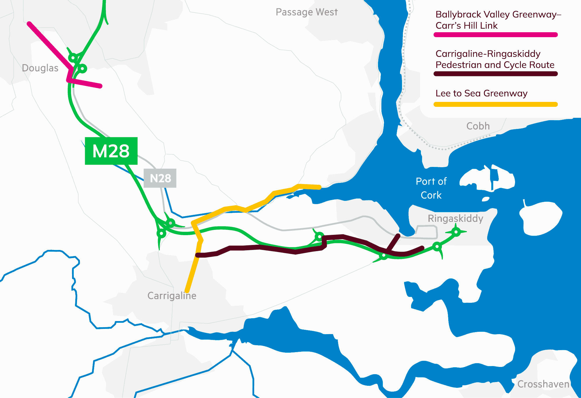
The M28 has been designed to facilitate and integrate with a number of existing and planned pedestrian and cycle routes, ensuring that local and regional connectivity is strengthened alongside the delivery of the motorway.
As part of the Ballybrack Valley Greenway–Carr’s Hill Link, the M28 facilitates a new pedestrian and cycle underpass beneath the motorway, providing a safe, direct connection between residential areas east of the M28 and Douglas Village. A section of the greenway is also being delivered within the M28 project boundary, ensuring continuity of the route through the scheme area.
The project also interfaces with the Lee to Sea Greenway, with the M28 facilitating onward connectivity towards Carrigaline town, supporting a continuous and accessible route for walkers, runners and cyclists along the harbour corridor.
In addition, Cork County Council is progressing the Carrigaline–Ringaskiddy Pedestrian and Cycle Route, which is currently at design and planning stage. The M28 facilitates this cross-country corridor, which runs broadly parallel to the motorway and is intended to provide a high-quality, segregated walking and cycling route between Carrigaline, Shanbally, Barnahely and Ringaskiddy. The scheme is intended to progress to Part 8 planning during 2025, subject to statutory approval.